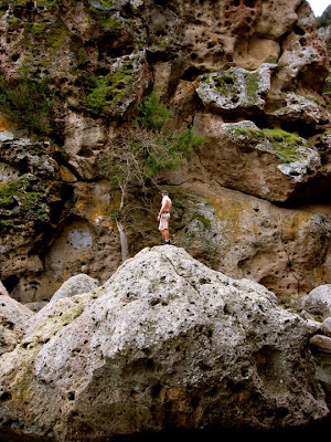
^ our trusty photographer
John Muir Trail 2011
The John Muir Trail (JMT) is a long-distance trail in the Sierra Nevada mountain range of California, running 211 miles (340 km) between the northern terminus at Happy Isles in Yosemite Valley and the southern terminus located on the summit of Mount Whitney. On August 3, 2011 we will begin this epic journey.
Thursday, March 3, 2011
Preparation Hike #2
So todays hike was a rather interesting one. Matt, my roommate Taylor (who is also our training photographer), and I went to Malibu Creek Canyon. I would say it is about six miles away from Pepperdine University through the Malibu Canyon. We expected to get in, walk the 5 mile trail, and then head back home. We were wrong. A mile in we start getting bored of the trail and happen to see this incredible portal that has a river running through it. So naturally we stray off the trail and start wading through this river. The rest of the day was spent rock climbing, wading through rivers, exploring, and in my case swimming in what felt like a freezing lake. Overall we had a really good time, ecspecially with the rock climbing. We all have some good cuts and bruises to show from the trip but it actually taught us alot. Most important thing I learned is that on a long distance trip getting your boots soaked is catastrophic. In no circumstance should you ever allow your boots to get fully submerged because it will kill you in the long run. I hope you all enjoy the pictures.
Wednesday, March 2, 2011
Mount Whitney
I thought it would be good to mention that the last section of our voyage consists of us trekking to the top of Mount Whitney. With that being said I thought some of you might enjoy some background information on the tallest peak in the continental United States. Mount Whitney is the highest summit in the contiguous United States with an elevation of 14,496.811 feet.[1] It is located at the boundary between California's Inyo and Tulare counties, just 84.6 miles (136.2 km) west-northwest of the lowest point in North America at Badwater in Death Valley National Park (282 feet (86 m) below sea level).[5] The western slope of the mountain lies within Sequoia National Park and the summit is the southern terminus of the John Muir Trail which runs 211.9 miles (341.0 km) from Happy Isles in Yosemite Valley. The eastern slope lies in the Inyo National Forest in Inyo County.
Tuesday, March 1, 2011
Preparation Hike #1
These are some pictures from our first preperation hike. We did a night hike on the mountain behind Pepperdine University and spent the night at the top of it. The next morning we woke up early to get some pictures of the sunrise.
Welcome
Hello and welcome. First off, we would like to thank you for checking out our blog. Our names are Matt Gibson, Justin Sullivan, and Travis Jones and on August 3, 2011 we will be beginning an epic journey that will be unlike anything any of us has ever done. This journey is known as the John Muir Trail. The John Muir Trail (JMT) is a long-distance trail in the Sierra Nevada mountain range of California, running 211 miles between the northern terminus at Happy Isles in Yosemite Valley and the southern terminus located on the summit of Mount Whitney (The highest summit in the contiguous United States with an elevation of 14,505 feet). The entire trip will take three weeks and will require us to carry what supplies we can on our backs. We will complete anywhere from 10 to 15 miles per day with 50 pound packs. This journey will require extensive training over the next five months to prepare us for the strenuous trek. For that reason, we as a group decided it would be beneficial if we created a blog and documented everything we do over the next six months; including our training and the actual 3 week trip. We hope you enjoy this blog and continue to follow us on our journey.
Subscribe to:
Comments (Atom)


